Bild Topographie Frankreich

Bild Topographie Frankreich
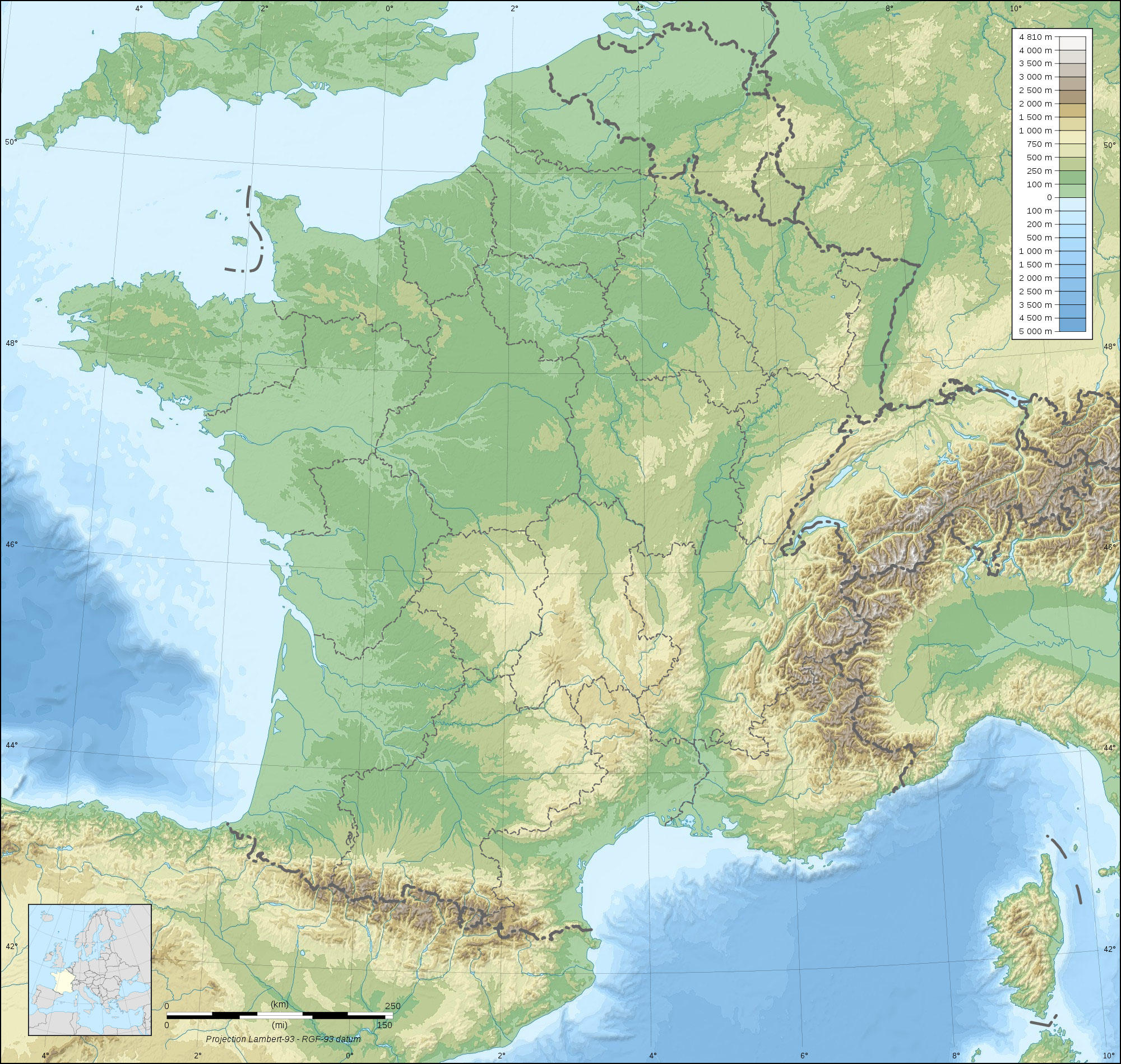
Clipart von Frankreich topografisch mit grünen und braunen Höhenunterschieden und sichtbaren Gewässern. Kostenlos herunterladen und drucken.

Kategorie: Bild Karten > Topographie Frankreich
Schlüsselwörter: Topographie Frankreich, Erdkunde, Landkarten
Image information
Attribution and Share-Alike required
Any use of this map can be made as long as you credit me (Eric Gaba – Wikimedia Commons user: Sting) as the author and distribute the copies and derivative works under the same license(s) that the one(s) stated below. A message with a reply address would also be greatly appreciated.
Sources of data:
- Topography: NASA SRTM30 (public domain);
- Bathymetry: NGDC ETOPO1 (public domain);
- Additional data: NGDC World Data Bank II (public domain).
Blank topographic map of France in the official Lambert-93 projection, with regions boundaries.
Alle Bilder dürfen für private, nicht-kommerzielle Bildungszwecke verwendet werden.
Für alle anderen Verwendungen siehe Bildlizenz und/oder Nutzungsbedingungen.
Bitte zögern Sie nicht, uns für weitere Informationen zu kontaktieren.
